Integrated Data: From Ground Truth to BIM
How We Delivered a Zero-Surprise Retrofit
Three integrated technologies working together to eliminate unknowns before construction begins.
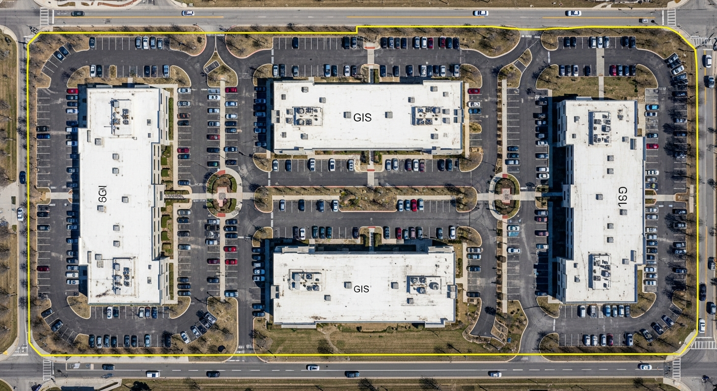
Aerial RTK Mapping
Captured centimeter-accurate site boundaries and roof data in 20 minutes using RTK-enabled drones. This provided the high-resolution "Base Map" for the entire project.
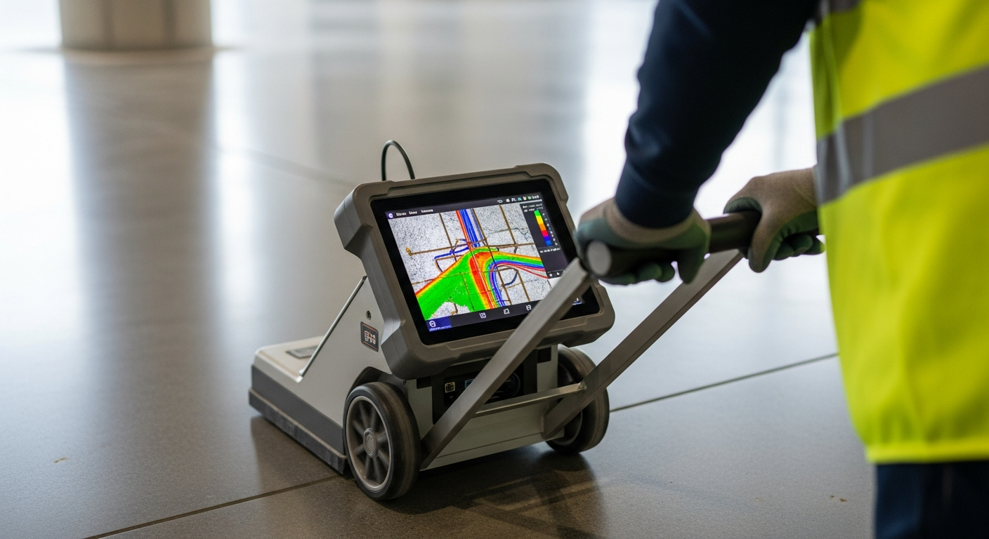
Subsurface GPR (Proceq GP8000)
Scanned concrete decks and foundations to visualize rebar and post-tension cables in 3D. This allowed for structural bolt placement with zero risk of hitting existing steel.
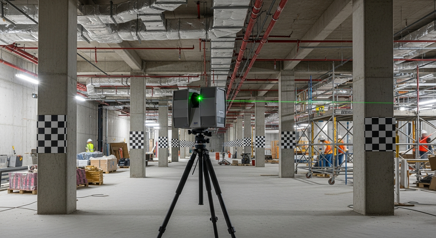
High-Density LiDAR Scanning
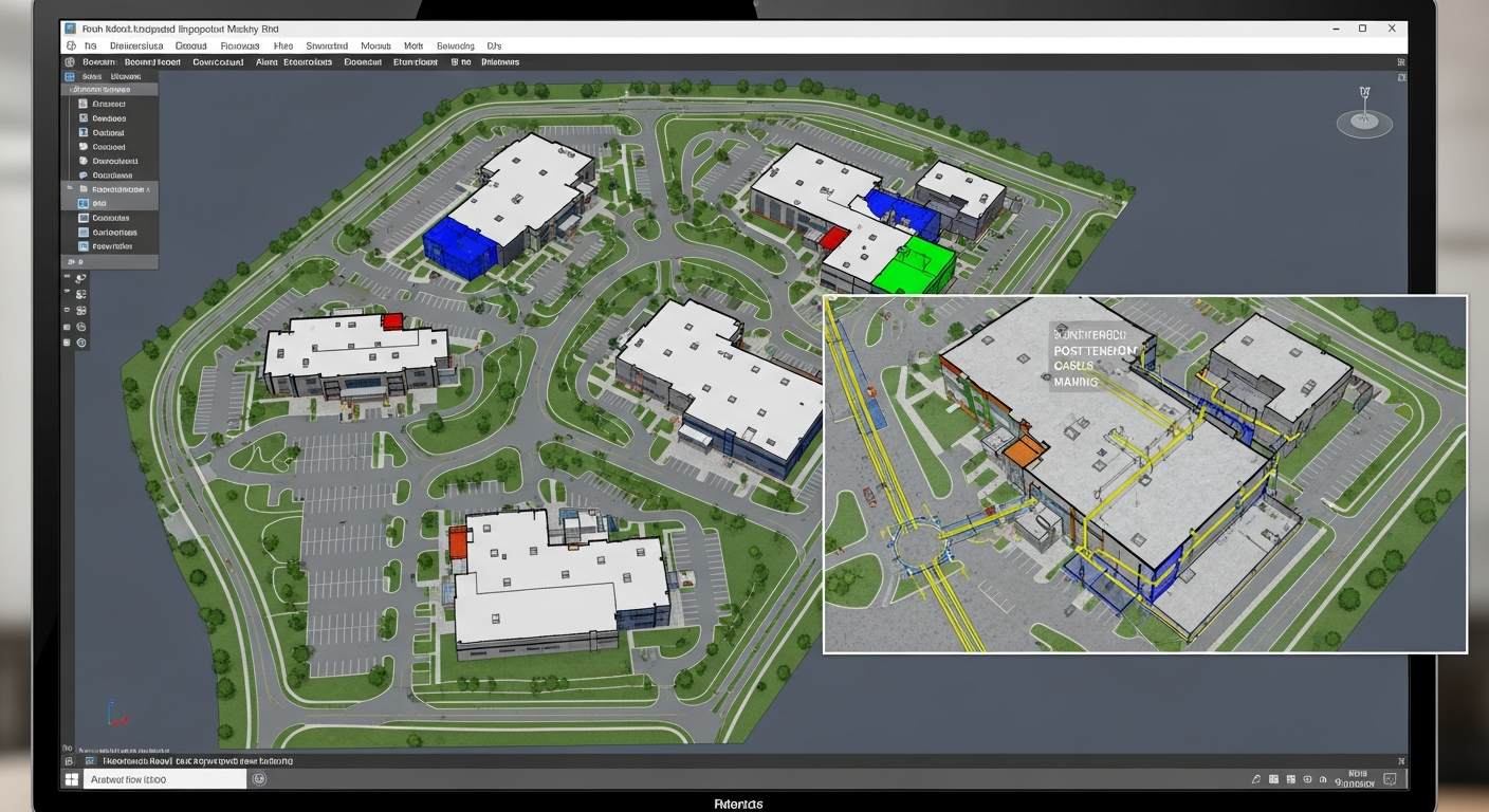
Generated a complete Digital Twin of the building interior and exterior. This point-cloud data was imported directly into Revit and AutoCAD for 100% accurate As-Built design.
Eliminate the "Field Measure Error."
By collaborating with our in-house architectural scanning firm, we eliminate the "Field Measure Error." Our design-ready files allow architects to begin work immediately with data they can trust, cutting design time by up to 40%.
The Challenge
A 45-unit commercial complex in Orange County required a full seismic retrofit. The original drawings were incomplete and unreliable, the concrete decks contained hidden post-tension cables that could not be hit during anchor bolt installation, and the project team needed a complete Digital Twin to coordinate across architecture, structural, and MEP disciplines. Traditional field measurement methods would have taken weeks, introduced errors, and still left critical subsurface conditions unknown.
Our Approach
We deployed a three-technology integrated approach. First, RTK-enabled drones captured centimeter-accurate site boundaries and roof data in 20 minutes, providing the high-resolution Base Map for the entire project. Second, we scanned concrete decks and foundations with a Proceq GP8000 ground-penetrating radar to visualize rebar and post-tension cables in 3D, allowing structural bolt placement with zero risk of hitting existing steel. Third, high-density LiDAR scanning generated a complete Digital Twin of the building interior and exterior. All three datasets were fused and imported directly into Revit and AutoCAD for 100% accurate As-Built design files.
Results
- Complete site documented in 5 days using all three integrated technologies
- Zero post-tension cable strikes during anchor bolt installation across all 45 units
- Design team cut project timeline by 40% using our design-ready BIM files
- Zero return site visits required — all field data captured in one mobilization
- Architect began design work immediately with trusted, verified data
- Engineering team identified and resolved 7 structural conflicts before construction began
Services Performed
- Aerial RTK Drone Mapping (Centimeter Accuracy)
- Subsurface GPR Imaging (Proceq GP8000)
- High-Density Terrestrial LiDAR Scanning
- Point Cloud Registration & Fusion
- Revit BIM Model (LOD 300)
- AutoCAD As-Built Floor Plans
- Structural Bolt Placement Coordination
- Post-Tension Cable Location Mapping
Project Gallery